Regular viewers will have observed that most of the walks on this blog to date have been weighted in favour of the South West Coast Path. In fact, N will tell you that I’m a little obsessed with paths. He is a man who will willingly veer off piste at the first opportunity, trusting his own (mostly) infallible sense of direction to take what looks like a more interesting route than the one prescribed by waymarker signs or the shallow furrow made by the many boots that have gone before us.
I, on the other hand, like a path. I like to know that this is the right, correct and approved route to follow, that no one is going to tell us off for inadvertently trespassing on their land (can you tell I was Head Girl at school?), and that we’re going to end up at the intended destination because, like Dorothy heading to Oz, we have done as we were told and followed the yellowbrick road, so to speak. The South West Coast Path therefore ticks a lot of my boxes: not only is it incredibly well signposted, the route is almost always obvious (not all that surprising, given that the sea is usually at your side to guide you) plus you have the added bonus of sweeping horizons and dramatic seascapes to entertain you as you step out in your Brashers.
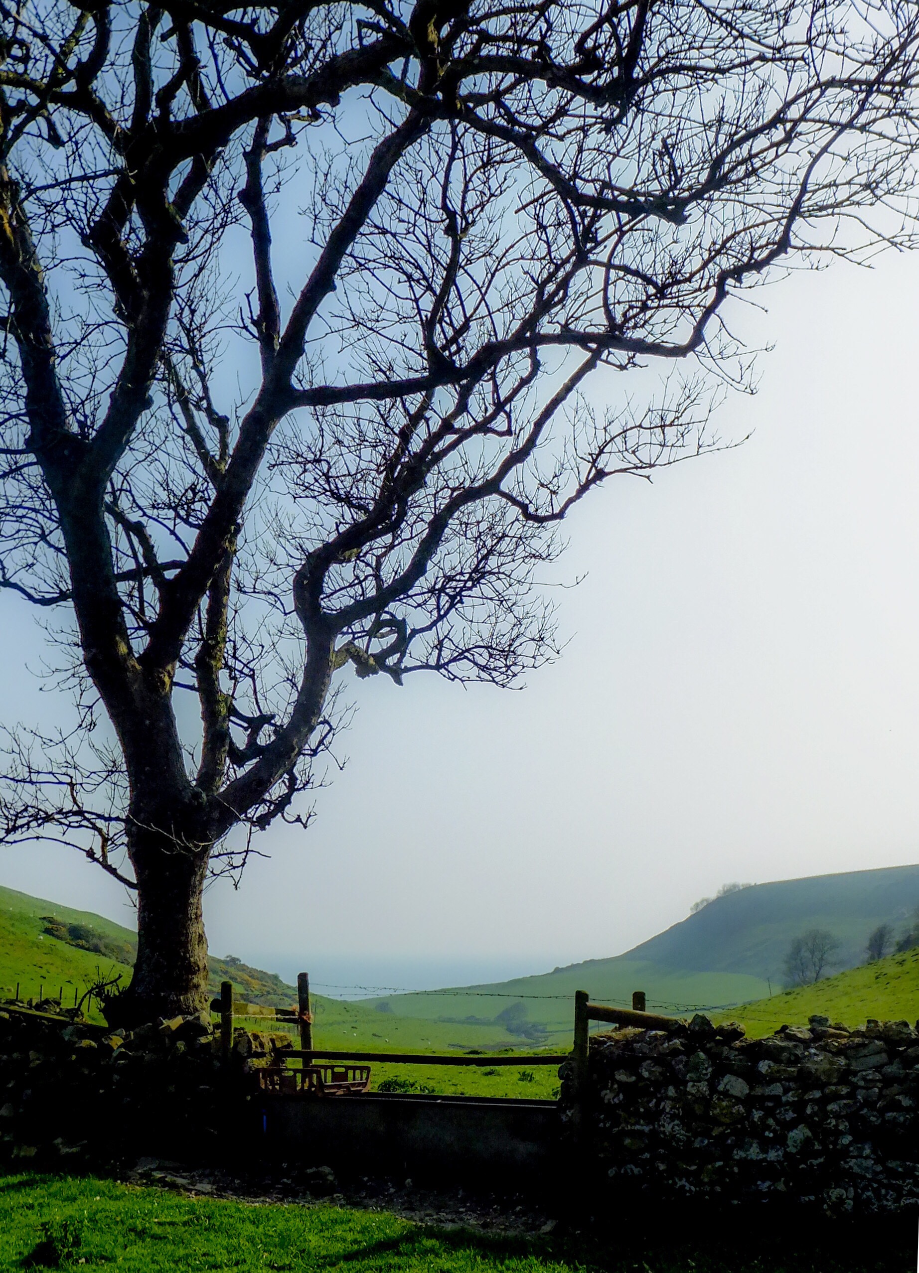
Therefore, the walk I did the other Sunday wasn’t an obvious choice for me. Don’t worry, I didn’t abandon the map, ignore the signposts and chart my own course up hill and down dale (*shudders at the thought*) but I did decide on a route I’d never walked before and one in which ocean vistas featured surprisingly little, given that I was within spitting distance of the sea. Would it be like going to the cinema and sitting with my back to the screen, I wondered?
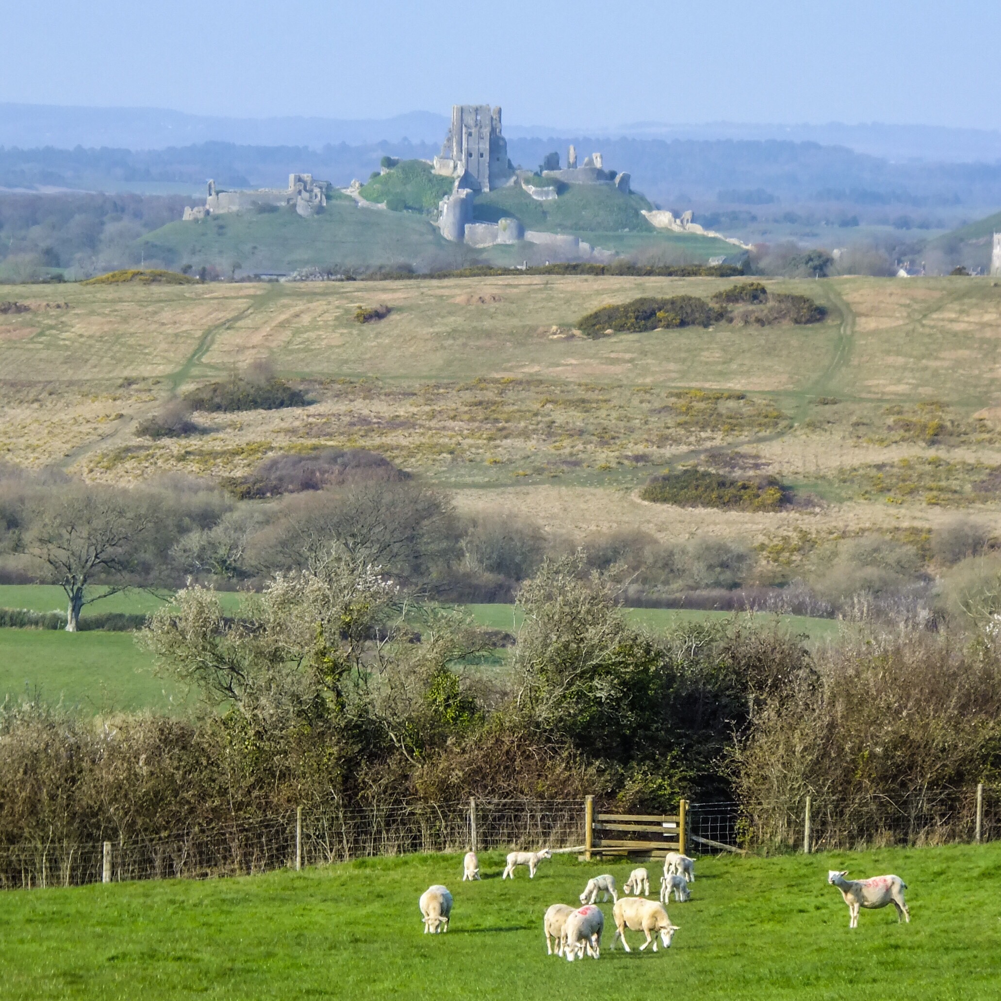
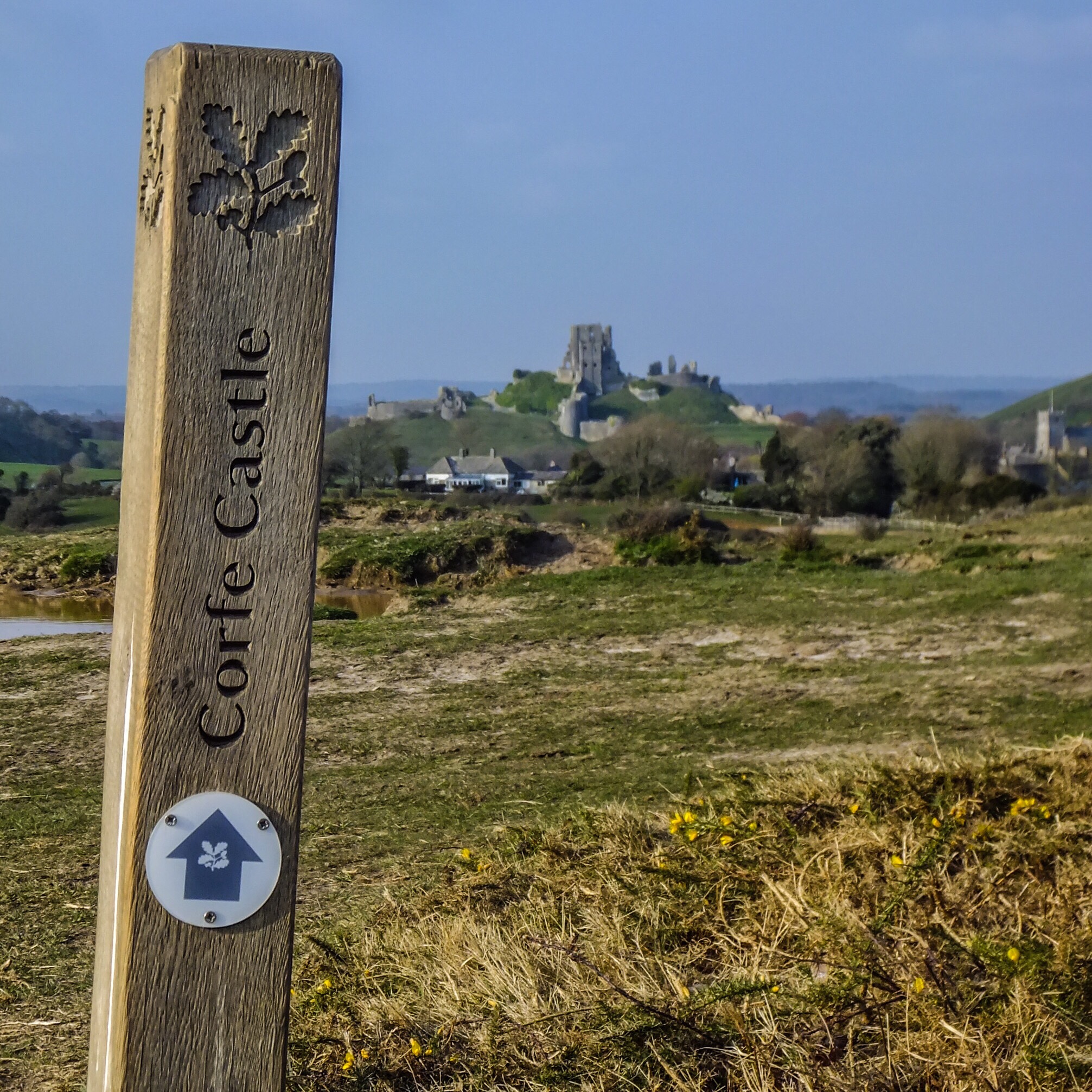
The beginning of the route certainly felt like that, albeit for different reasons. Starting out in Corfe Castle, I turned away from the famous ruin that everyone else was there to see and headed south out of the village and on to Corfe Common. This is an area of ancient grassland that I’d paid little attention to before, even though our usual route to the coast runs through it. Seen through the car window, it looks a little scrubby and uninteresting compared with the show-off castle and chocolate-box village that you’ve just passed. On foot, its appeal is a little more apparent. Ponies graze amongst the gorse and skylarks sing overhead; according to the National Trust, it is one of very few sites in Dorset where the endangered electric blue damselfly can be seen. This path-loving walker enjoyed the medieval sunken lanes, the muddier ones topped with mini boardwalks, taking you along the routes that were once used to transport stone from Purbeck’s limestone quarries to the village of Corfe.
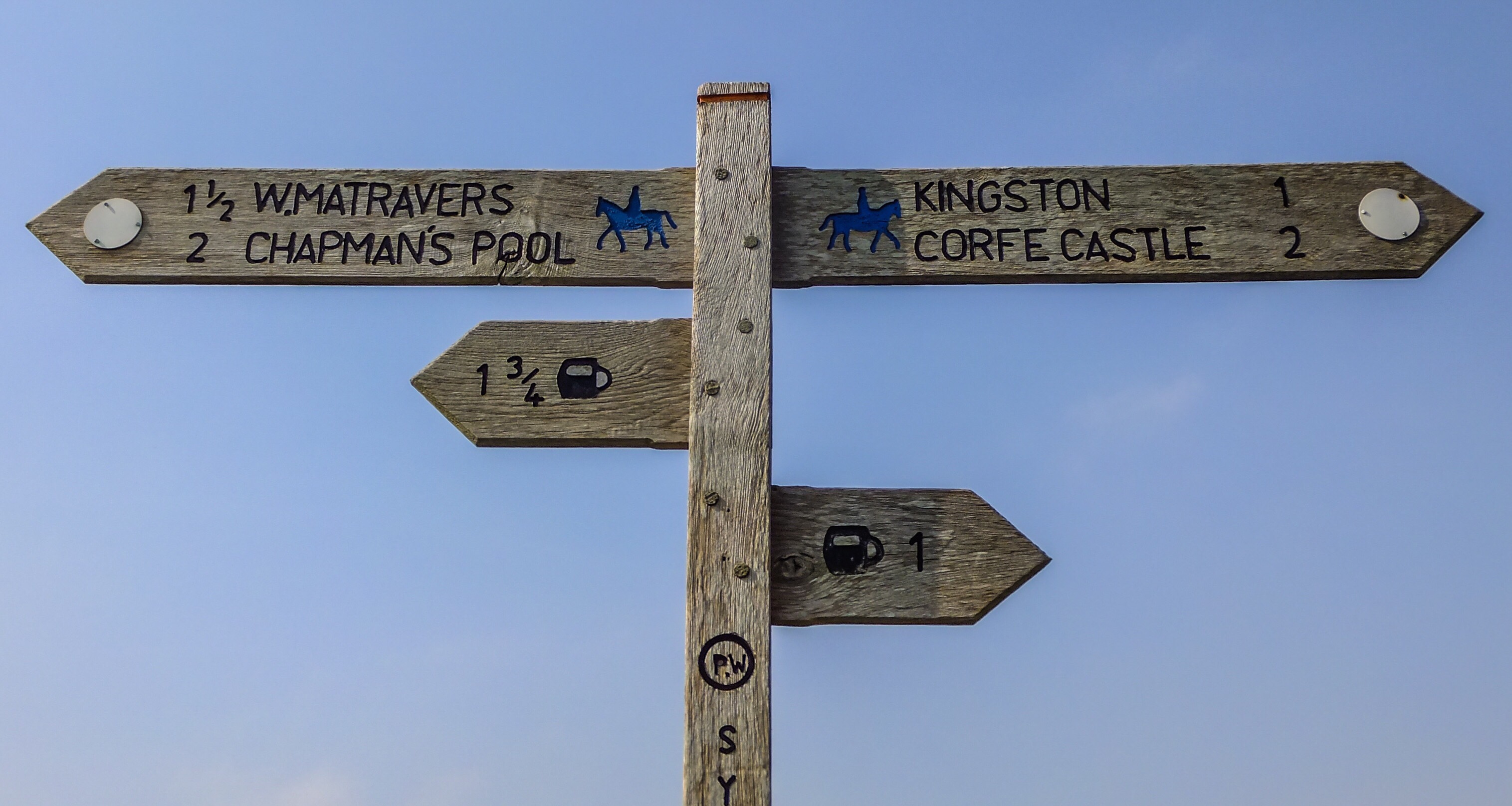
You have various route options across the common but I followed the Purbeck Way signs (I told you I wouldn’t go off piste), which eventually led me over the B3069, along the edge of some lush, tree-fringed fields and on and up a wide unmetalled track before crossing the road once again. Here, you make a slight dog-leg and continue down the path that runs between two houses. Along this stretch, each waymarker sign is keen to point out the distance to the nearest pub, both the Scott Arms at Kingston and the legendary Square and Compass at Worth Matravers being within relatively easy reach.

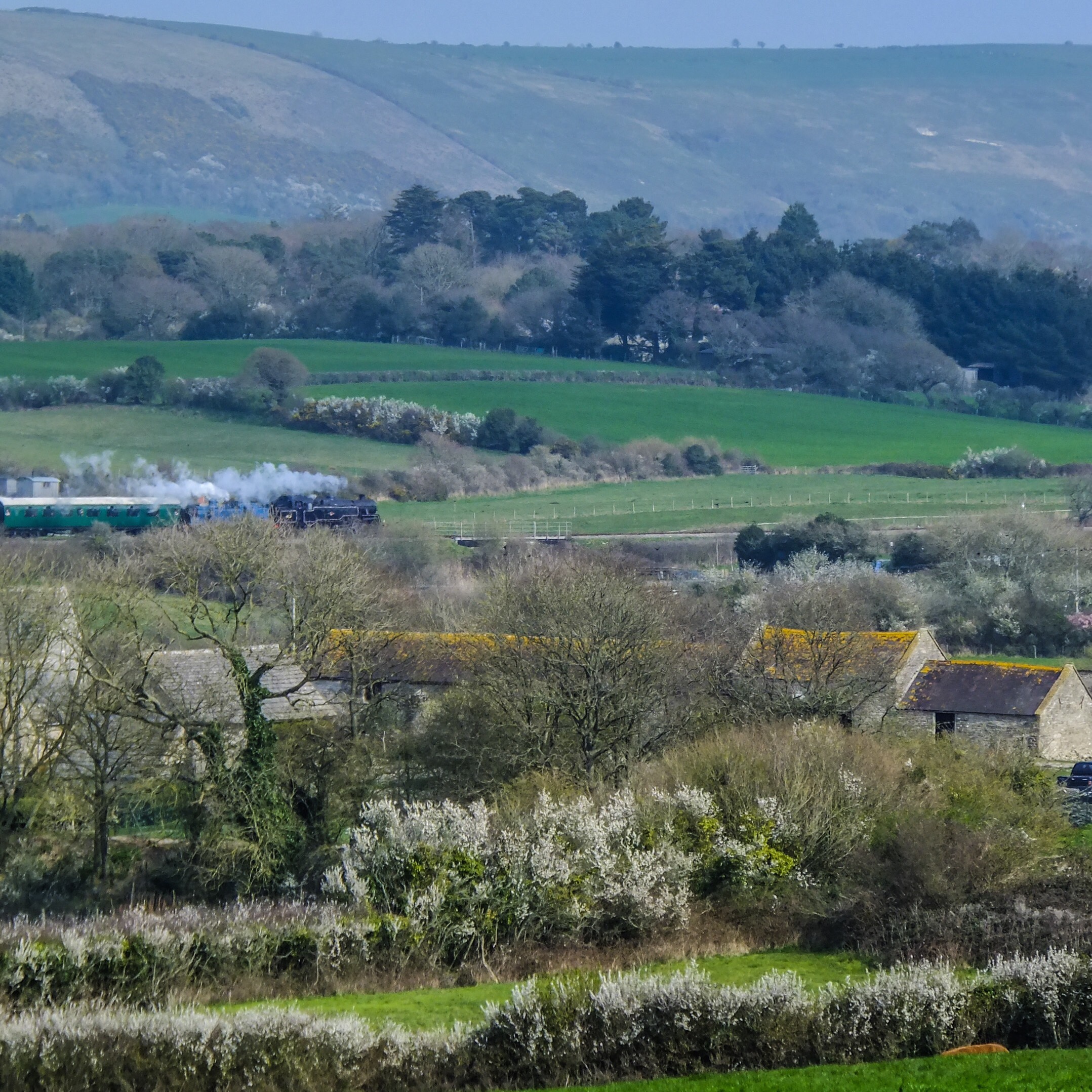
After a little meander between the fields, the path drops down steeply into Coombe Bottom, where it’s just you and the birds for a while. Again, for an area that I thought I knew well, I had no idea this secluded wooded valley was there. Follow the combe along for a little way and Swanworth Quarry, one of the remaining working quarries and a source of the aforementioned Purbeck limestone, soon comes into view. The path then veers to the right and on into Hill Bottom. This part of the combe is even prettier than before and joyously noisy with birdsong. On the day of my walk, I had the place pretty much to myself; it had the feeling of being somewhat untouched by time, the ruins of an old dry stone wall covered in a thick coating of moss.
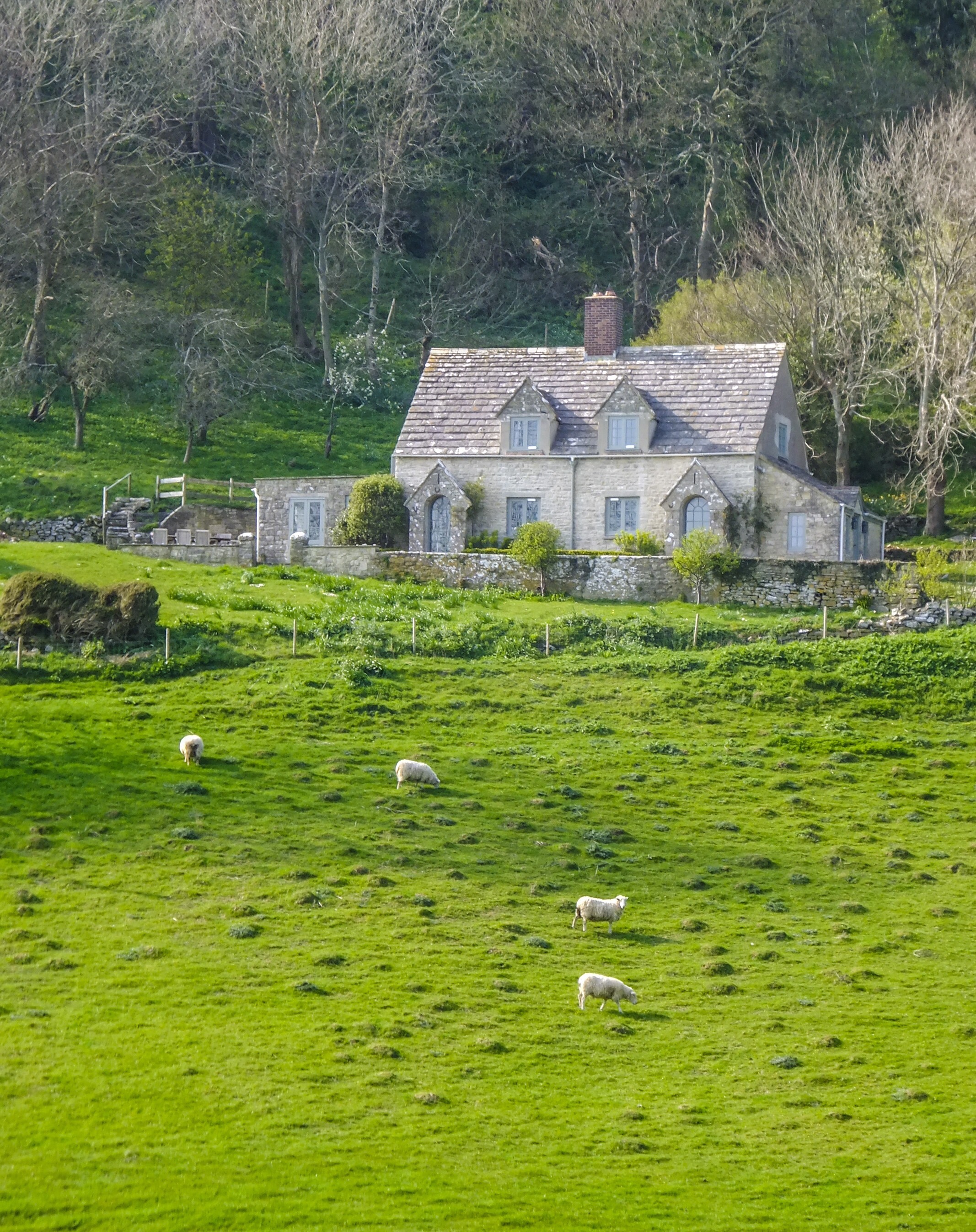
Continuing onwards with the trickling stream beside me, I ignored the sign tempting me up the hillside to the village of Worth Matravers and the Square and Compass, and instead joined the narrow tarmac road leading down to a small cluster of houses. If I’d had more time, I would have continued a little further to the small cove of Chapman’s Pool and dipped my toes in the sea. However, I was conscious that I needed to be back in time to meet N for our usual Sunday evening pub roast. (Believe you me, it would be end of days if N missed his Sunday roast …) So, instead I headed west and picked up the South West Coast Path for a short while, rounding the bottom of the hill to head back inland towards Kingston village, pausing for a moment to coo at the solitary farmhouse that sits on the side of the valley looking out to sea. N and I have a fantasy portfolio of Purbeck properties that we would love to buy if we won the lottery, and this is one of them. Never mind whether the current owners want to sell, of course: we’ll cross that bridge when we come to it.
The path continues on and up through the green valley where sheep gently graze until it eventually leads into Kingston after passing a walled tree plantation on the left. Even though the clock was ticking, I calculated that I had just enough time for a swift half of Dorset Knob at the Scott Arms, a pub with a great beer garden looking towards Corfe Castle, before picking up the Hardy Way at the back of the village. (Question: why is a half so much more delicious than a pint when it’s all you can have?) From here, the route is clearly laid out before you through the fields as the castle beckons you back to Corfe Common and the village.
Need to know
OS Map: OL15 Explorer map of Purbeck and South Dorset (again!)
Parking: West Street Car Park in Corfe Castle
Public transport: Comprehensive information about travelling to Corfe Castle via public transport is available on the Corfe Castle website.
Refreshments: Corfe Castle offers as many pubs and tea rooms as you would expect from a tourist honeypot. On the walk itself, you can take the detour that I resisted and head up to Worth Matravers for a pasty and a pint at the Square and Compass or wait until you get to the Scott Arms in Kingston.
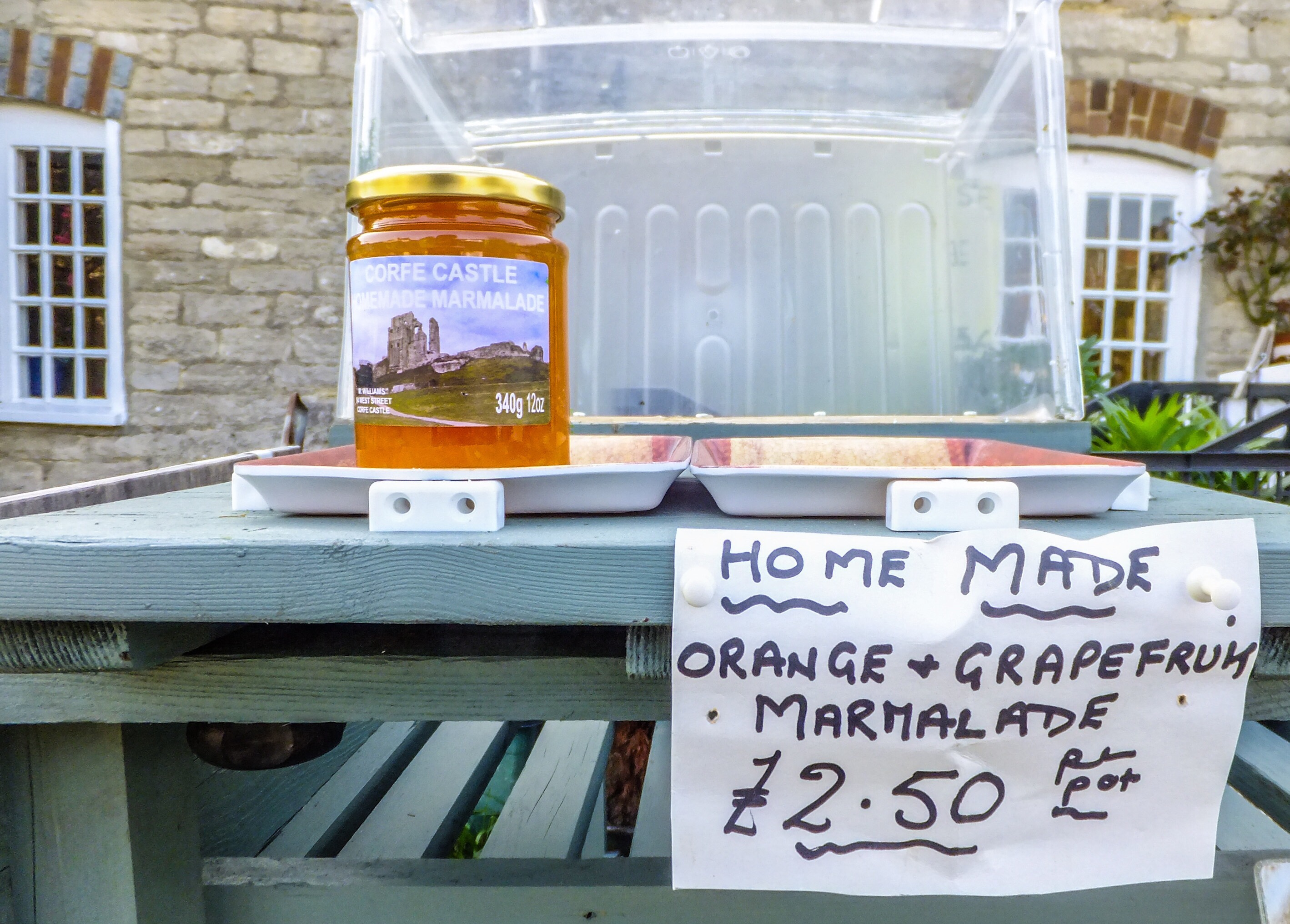
Duration: My OS route planner app said the full route would take two hours and 20 minutes. Allowing for my dawdling to take photos, cooing at other people’s houses, stopping for a beer and making a purchase from an honesty box, I’d say it was more like four hours at a leisurely pace. The total distance is around six miles and, while hilly in places, the terrain is generally much less strenuous than other walks on this blog.

The opening two paragraphs of this article could be describing us. The accuracy is uncanny! Really enjoyed reading this post and will look forward to doing this walk ourselves.
I’m glad I’m not the only one who is fixated on following paths! It’s a great walk, and a bit less obvious than the coastal ones. I’d love to know what you think of it.